What is GLONASS And How It Is Different From GPS
Many of you who are reading this likely know what a GPS is. GPS stands for Global Positioning System and it allows you to find out where you are and where certain things are located. Many use a GPS system when trying to find the best route to get somewhere.
The GLONASS is, more or less, Russia’s version of a GPS. It stands for Globalnaya Navigazionnaya Sputnikovaya Sistema, or Global Navigation Satellite System.
There are different variations of GLONASS, and differences between a GPS and GLONASS, that will be covered throughout this article.
Quick History of GLONASS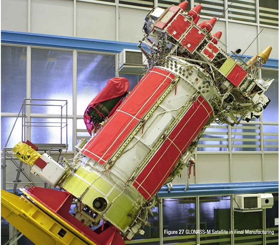
The Soviet Union had begun developing the GLONASS in 1976. Because it is still being run today, it still takes money to run. As of 2010, GLONASS was the costliest program of the Russian Federal Space Agency, consuming around a third of the agency’s budget.
Because of how long GLONASS has existed, there are several variations of the program and more that are scheduled to be released. This includes:
- GLONASS, where satellites launched in 1982 were meant to be used by military and official organizations to determine weather positions, measure velocity and timing wherever in the earth or in space near the Earth
- GLONASS-M, which was launched in 2003 and added a second civil code, something significant for GIS mapping receivers
- GLONASS-K, which started in 2011 and added a third civil frequency
- GLONASS-K2, which is currently expected to launch in 2018
- GLONASS-KM, which is currently being researched and will be launched sometime after 2025
- A-GLONASS, or Assisted GLONASS, is a version of GLONASS for smartphones
If you noticed, the last version of GLONASS is a bit different from the others. It provides features like real time traffic information and step-by-step navigation directions. It can quickly locate you through the cell towers closer to your place with some help from your data connection.
Cost of Creating and Upkeeping GLONASS
From the time GLONASS was created until about 2011, the Russian government spent around $5 billion on the project. They also invested another 320 billion rubles, or $10 billion, to cover the years 2012 to 2020.
Despite other projects that have been worked on and funded by the Russian Federal Space Agency, GLONASS is the most pricey project ever run by the space agency.
So What Are the Difference Between A GPS and GLONASS?
The first major difference was that GPS was developed by America while GLONASS was developed by Russia.
The second major difference is how large the network of satellites each one has covering the planet. GPS has a network consisting of 31 satellites while GLONASS has a network with 24 satellites.
The last major difference that is pretty important is that GPS is in wide commercial use thanks to devices like smartphones and navigators. The GLONASS was mainly used by Russian military or official organizations.
For those of you who may be interested, I’ll be including a list of specifications of each system to better showcase differences and similarities between the two systems below. If you aren’t, you may want to go onto the next section now.
Here is the list of specifications for a GPS:
- Uses CDMA coding
- Has 31 satellites
- Orbits 19,130 km above Earth
- Location accuracy is within 3.5-7.8 meters
- Has a 55-degree orbital plane inclination
- Has an orbital period of 11 hours and 58 minutes
- Has a frequency of 1.57542 GHz for an L1 signal and 1.2276 GHz for an L2 signal
In comparison, here is the list of specifications for GLONASS”
- Uses FDMA coding
- Has 24 satellites
- Orbits 21,150 km above Earth
- Location accuracy is within 5-10 meters
- Has a 64.8-degree orbital plane inclination
- Has an orbital period of 11 hours and 16 minutes
- Has a frequency of 1.602 GHz and 1.246 GHz
Is A GLONASS Better Than A GPS?
There really isn’t a clear advantage of one over another. GLONASS doesn’t have as strong of coverage as a GPS does but it is better for areas that are farther north, as it was created for Russia.
However, if a GPS and GLONASS are used together, there will be an increase in how accurate the coverage is. Using both GPS and GLONASS allows whatever device you are using to be pin-pointed by the 55 satellites used for tracking around the globe. This basically mans that if you are in an area where GPS signals can get stuck of mixed up, like in a subway, GLONASS satellites can still accurately keep track of your location.
Is There a Commercial Market for GLONASS?
The first time GLONASS was used commercially, it was in a car navigator as Glospace SGK-70. However, it was pretty bulky and costly.
The iPhone 4S was also the first Apple product to use both GLONASS and GPS to help pinpoint locations on the map.
Currently, the Russian government is trying to promote a more widespread use of GLONASS in the commercial market, although it seems as if it is outshone by its American counterpart in some cases.
One thing that is helping them promote GLONASS even just commercially is that now all high-end device with GPS capabilities include GLONASS receivers on their chips so it can use location based services.
This means that all smartphone, no matter how expensive the phone may be, have an A-GPS installed automatically. A-GPS uses your network capabilities of finding your location.
Your location can be more accurately tracked with both GPS and GLONASS technology used within your phone. Currently, only Flagship and high quality smartphones have the capability of using dual core location services. Eventually, this type of technology will be available on all types of smartphones despite price. This is because more chip manufacturers and companies are gaining more interest in GLONASS technology.
Smartphone Manufacturers with GLONASS Compatibility
So the list is actually fairly long to list out every single model out there that has the ability to make use of the GLONASS satellites. Instead, I am going to create a list of manufacturers who have made at least one model of phone with the ability to access the system.
This list has a wide range of manufacturers, including:
- Acer
- Alcatel
- Apple
- Asus
- BlackBerry
- HTC
- Huawei
- LG
- Meizu
- Motorola
- Nokia
- OnePlus
- Samsung (which has the most models able to access GLONASS)
- Sony Ericsson
- Starmobile
- Sony
- Xiaomi
- ZTE
LG, Samsung, Sony, and Motorola have many models of phones available that can access both GPS and GLONASS satellites. If you are really searching for a phone that is capable of accessing GLONASS, those may be some good phones to look at first.
So How Will Current Mapping Systems Change?
Something you may have stopped to consider while reading this article is that many mapping systems seem to only use GPS technology. So how will GLONASS be implemented into these applications properly?
All you will need is the proper transceiver for GLONASS technology within your phone and there you go!
It will function in a way very similar to how your GPS does. This is the same for any mapping app, but take Google Maps for instance. Google Maps will access your data connection in order to connect to the satellites within the GPS and GLONASS systems. You won’t be required to add anything extra or download a totally different app aside from the one that comes as a factory default on your phone. Unless you want a new app, that is.
GLONASS and GPS: Final Thoughts and The Future of Global Positioning
GLONASS and GPS, in my own opinion, sound like a fantastic edition to new technology! You can get better readings on where you are or where you are trying to go this way.
I hold the belief that, to continue moving forward technologically, we must improve everything as much as possible and implement it. That’s no different for global positioning technology. And there are already plans underway for new systems to be implemented.
The European Union is working on a system they call GALILEO. This is meant to provide incredibly accurate location services to everyone. This system will consist of 30 satellites, 27 of which will be operational with another 3 as spares. They will be positioned 23,222 km above Earth in three Medium Earth Orbit planes and at an inclination of 56 degrees relative to the equator.
Meanwhile, China is developing its own set of satellites. They are calling their system the BeiDou Navigation Satellite System. It has been under construction since January 2015 and will offer more services as compared to the current GPS system. As of now, it is operational use within China and the Asia Pacific region with the use of 11 satellites. It is expected to be available globally in 2020.
The Indian Space Research Organization is developing the IRNSS, or Indian Regional Navigation Satellite System. It is meant to offer restricted service and public service for those like the military. The system itself has 7 satellites. It is currently being worked on to become entirely functional and operational for commercial use.
There’s all the information I currently have in regards to GPS and GLONASS! Hopefully this has provided some insight into how this is going to impact the smartphone market, future navigator, and how global positioning systems are going to upgrade and expand in the future.
Related Posts


About The Author
Littlegeek
Tech Geek Since 1985 - Cheif Geek at biglittlegeek.com since 2014, All around tech lover sharing great tips and advice online since 2004.
